应用截图
详细介绍
Change satellite images in mapping websites.
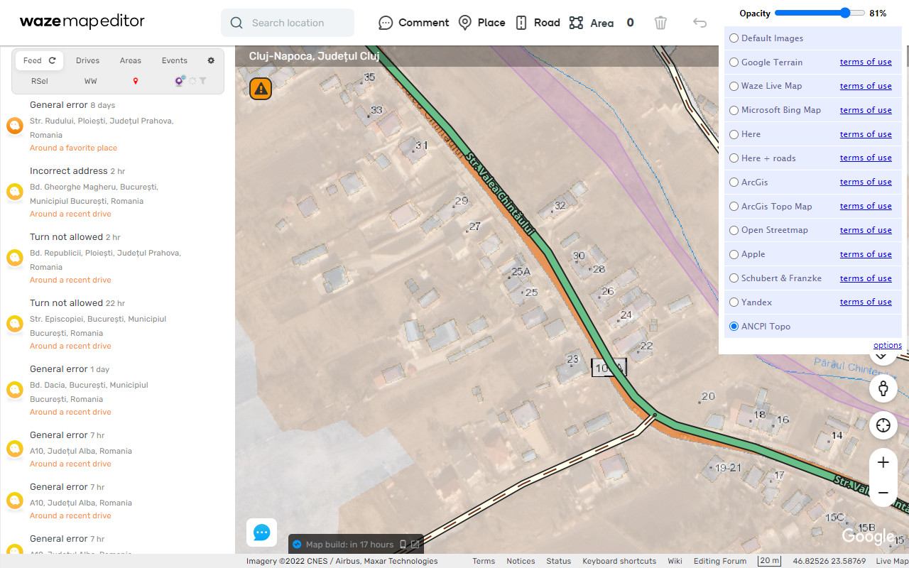
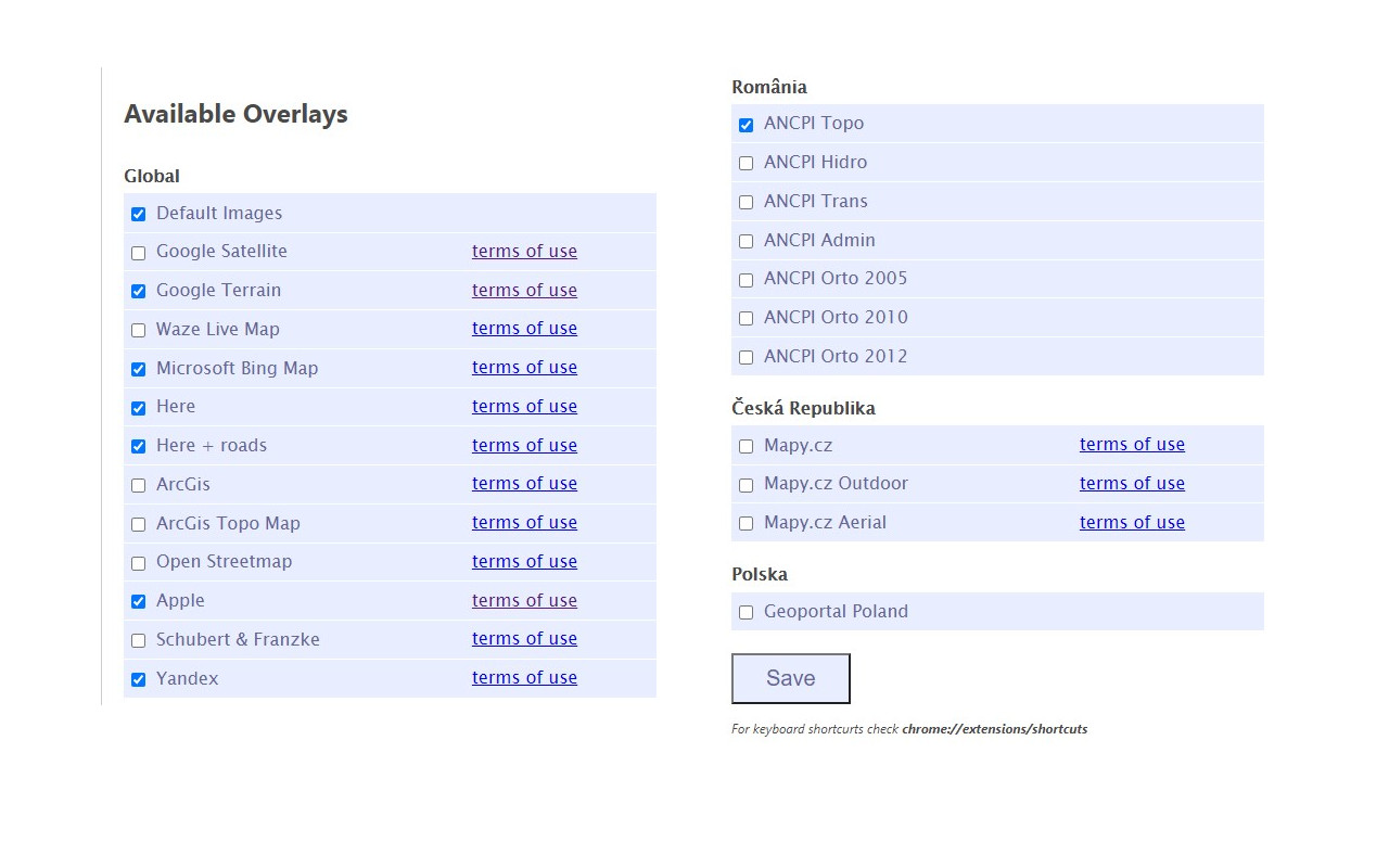
Provides an easy way to change the satellite images displayed in Google My Map and Waze Map Editor. There's several international maps available and some country specific (Romania, Poland, Check Republic, France).
Supported sites:
• waze.com/editor
• google.com/mymaps
After installing the extension, you'll need to pin it to your Chrome toolbar. This will make its icon appear at the top of your browser window. Once pinned, you can use the icon to interact with the layer selection menu and other extension features.
There is a shortcut, default Alt+L, to switch between the default layer and selected layer. You can change the keybinding in the chrome settings chrome://extensions/shortcuts
Do not use layers for editing the maps unless you comply with the terms of use specific to each layer provider.